

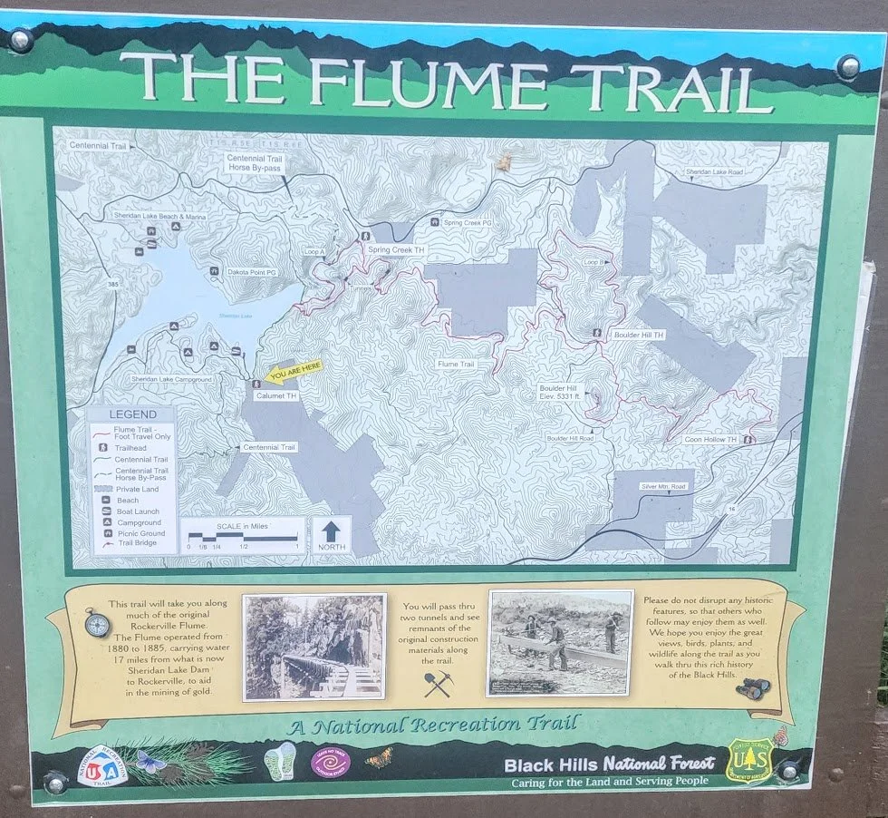
Spring Creek Centennial Flume Trailhead
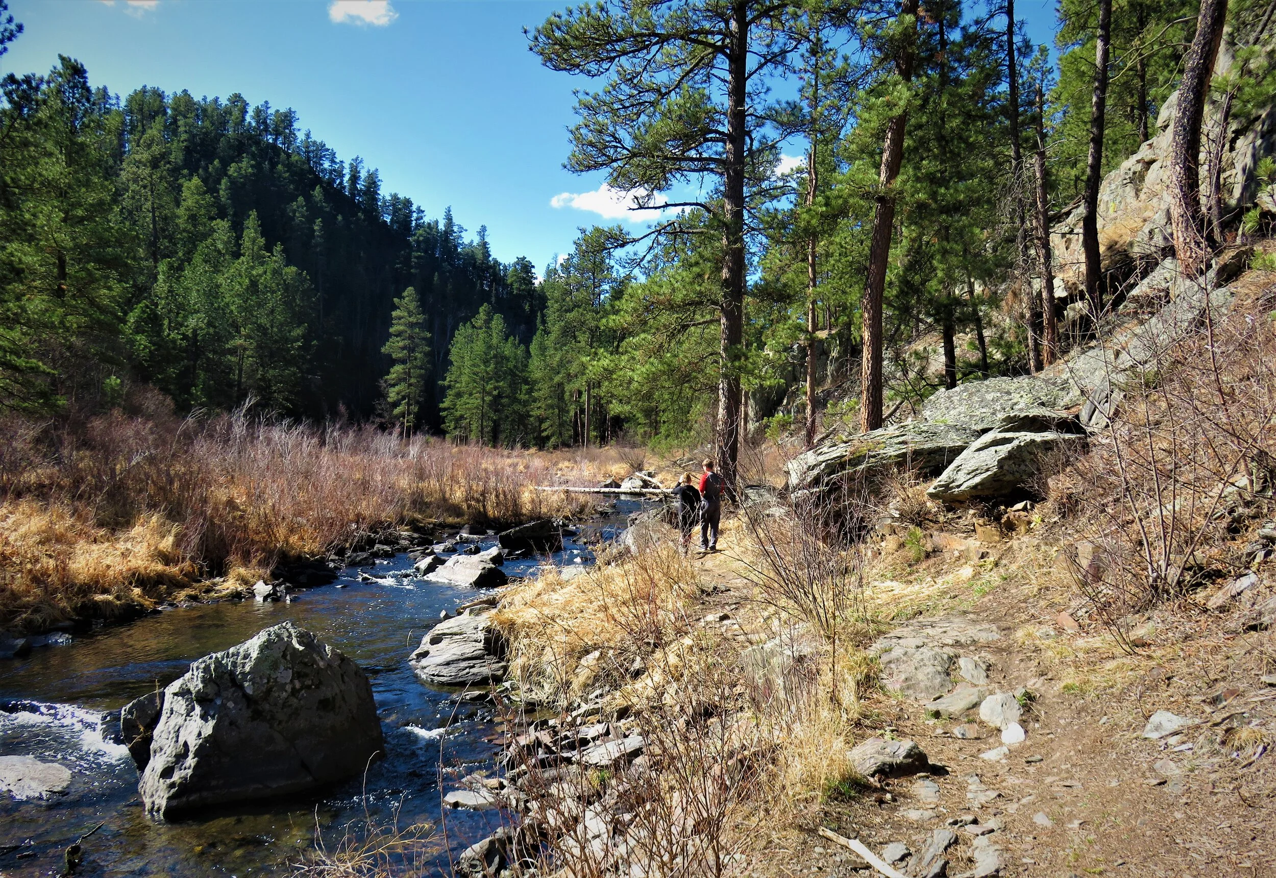
Spring Creek Loop Trail is around a 4 mile loop trail that follows the Flume Trail for a bit, Spring Creek for a bit, and takes you to the east end of Sheridan Lake. The trail can be done numerous ways depending on your hiking ability and what you want to see. You can do the whole loop, just hike to the two tunnels, or add another 2 miles and walk the Flume/Centennial Trail. No matter what you do there are up to 4 bridges you have to cross if you do the whole loop, and only 2 (there and back) if you decide to just go to the tunnels. The bridges can be hard to cross for some - they are narrow, tend to sway, and have no railings.

Sign to turn onto from Sheridan Lake Road - Plenty of places to park.

Bridge to cross just north of the parking spot to start your hike*******
To start your hike - cross the 1st bridge just north of the parking lot. Take the trail (easily marked) that goes up the hill. This is a pretty easy 1/4 mile hike up and takes you to the Flume Trail. The trail splits while walking up - both go the the exact same spot - The Flume Trail.

View from the bridge - very pretty
Once on the Flume Trail take a left to go to the Short tunnel. This is about 1/2 mile away.

Hiking the Spring Creek Trail/Flume Trail

On the Flume Trail - the river below

After 1/2 mile the second tunnel appears. Very short, but cool

The second tunnel from the other side. The trail starts to narrow and doesn’t really go anywhere exciting.
Once you see the second tunnel, turn around and start walking back, passing the trail you came up. This will take you to the first tunnel which is a lot longer. This tunnel is pretty cool and kids love it. The tunnel can be flooded at times, the boards on the inside can sway, it is pretty dark in the tunnel (may want to bring a flashlight), and the tunnel is low so watch your head. If you do not want to walk through the tunnel, you have the option to walk over it.

Nice and easy walk - On the way to the 1st tunnel


First look at the 1st tunnel

The long tunnel from the other side
Once you go through the tunnel the view is of Sheridan Lake dam - the trees cover most of it, but if you look hard you can see it. The Spring Creek river is also below. If you want to end you hike and turn around and go back you can. The total trip of you hike is around 2 miles.
If you want to continue and do the loop, from here it starts to get a little harder. There are a lot of rocks you have to walk over, more bridges to cross, and total miles now becomes around 4 or longer depending what you want to do.

Once you get past the long tunnel, the trail gets a little harder

The Flume Trail/ Spring Creek Trail - very rocky at times. Can be slippery

On the Flume Trail looking down - can see the bridge you need to cross and the Sheridan Lake dam.

On the way down to Sheridan lake - First real view of the lake
Once you hit the lake you have 2 options - take the trail below the dam to get back to your car (total around 4 miles). The second option is make this a longer hike (add 2 more miles) and walk the Flume Trail/Centennial Trail. This will put your hike around 6 or so miles. I highly recommend this if you are up to it. The trail follows Sheridan Lake the whole way and ends up at Sheridan Lake Campground. This part of the trail is also very easy.

Flume Trail/Centennial Trail following Sheridan Lake
If you are not up for the extra miles then just head to the dam, and take the trail just below the dam (walk through the gate). Before you go if you want to explore the area go ahead. You can walk across the dam and climb the steps to the bridge that is over the spillway.
Once you take the trail below the dam, the trail follows the river and there are 3 more bridges to cross. The trail takes you near the spillway, which is cool to see and several places along the creek are beautiful.

Just north of above, there is usually a pretty neat flow of water - see picture below.

Up behind the Sheridan Lake Dam to the north.

The bridge just below the dam

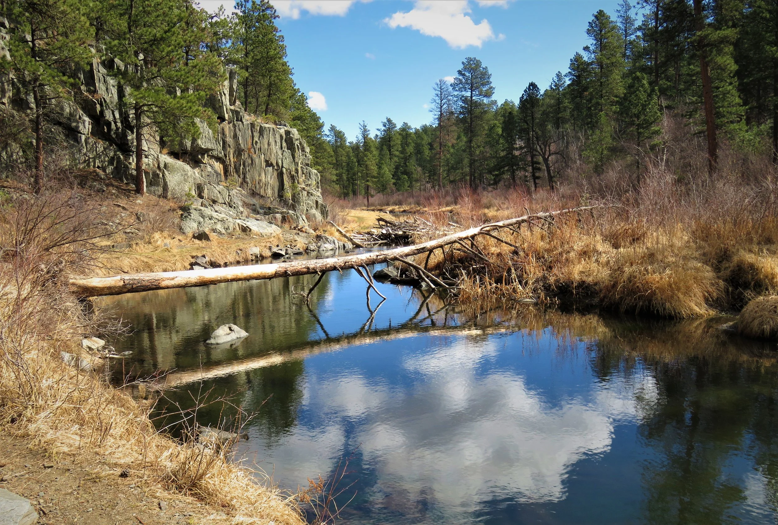
Spring Creek


One of the 4 bridges you have to cross on Spring Creek
Spring Creek Trail in the fall.

Spring rains washed out the bridges, and took away the tree above that had crossed the river for a long time.


Spring and summer did bring lots of pretty flowers.


Just as pretty to walk the trail in the winter.


If interested click on the link below for more information on the The Rockerville Flume Trail.
Click on the Link below to see our track of the trail. Note that the the first part of the track shows the section that leads to the 2nd tunnel.